DI地图题是描述图片的各种图片类型中较为复杂的一类,需要考生从图片中提取较多的信息内容,再根据地图框架将语言组织起来。羊驼在线老师今天给大家带来一道地图例题的讲解,希望能对考生处理此类问题有所启发。
题目:

解析:地图框架
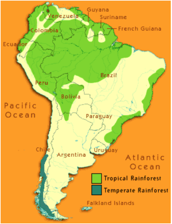
1. 标题:South American rainforest
2. Items: tropical rainforest, temperate rainforest;
3. 第一个颜色区域: green color area, top of the picture, Colombia,Brazil;
4. 第二个颜色区域: dark green color area, bottom of the picture;
5. 总结句
第一部分:PTE口语DI地图题标题及items

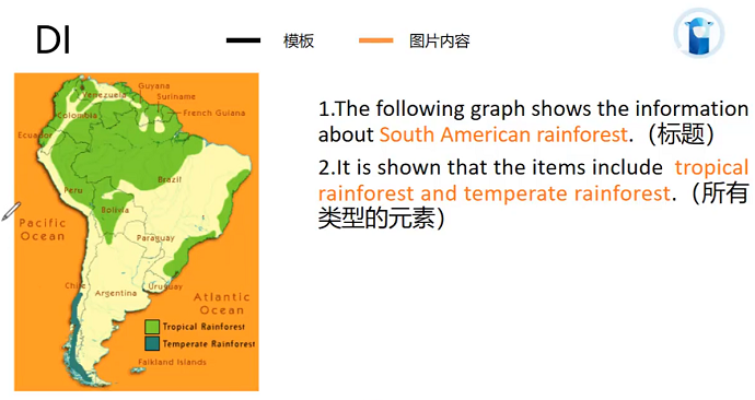
上图是例题标题及总括句的答题示范,黑色字体为框架部分,橙色字体为图片信息内容。
在观察本题图片后可以得知,本题是一个非常规的图片题,在这时想要进行总体描述,就需要考生从图片提取足够的信息:
1)标题部分,例题图片没有明显标题,需要进行提炼,本图可以看出是南美地区的地图,可以直接用South America,还可以仔细看出,本图主要描述的是热带雨林的部分,因此标题可以定为South American rainforest;
2)总括句部分,需要考生提取items,本例题可以直接将右下角的地图颜色描述部分作为items,直接填入tropical rainforest、temperate rainforest。
例文示范:The following graph shows the information about South American rainforest. It is shown that the items include the tropical rainforest and the temperate rainforest.
第二部分:PTE口语DI地图题内容描述及总结句

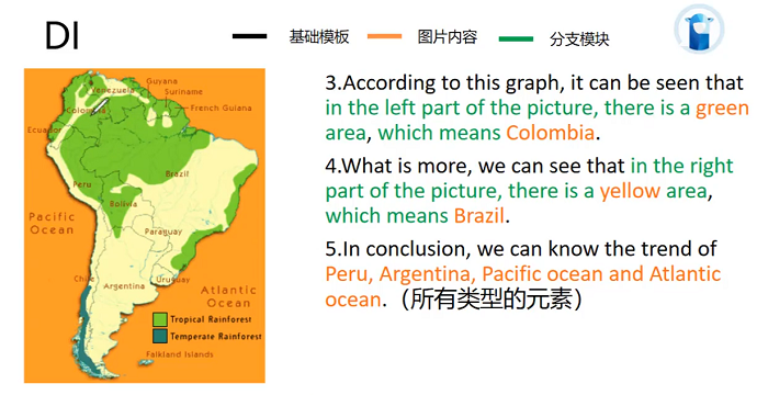
之后,需要进行更仔细的描述,上图是答题示范,黑色字为框架部分,橙色为填入的信息内容,绿色部分则是考生可以选择进行描述的部分。
1)第三第四句话,需要根据内容填入不同的信息进行描述,地图框架常用的是上下左右的方位作为逻辑来表达,重点是将地图的部分、颜色和表达信息结合起来表述。例如本题使用了Colombia和Brazil;
2)总结句,尽量说没有提到过的一些国家,或者是说一些没有提到过的items。
例文示范:According to this graph, it can be seen that in the left part of the picture there is a Green area, which means Colombia. What is more, we can see that in the right part of the picture there is a yellow area, which means Brazil. In conclusion, we can know the trend pro Argentina, Pacific Ocean and Atlantic Ocean.


